Before & After
See the Difference Professional Editing Makes
Every image we deliver goes through a meticulous editing process designed to bring out the best in your property or project. From HDR processing and color grading to sky replacement and perspective correction, our post-production workflow transforms good aerial shots into stunning, market-ready imagery. Drag the sliders below to see exactly what professional editing does for drone photography.
Editing Comparisons
Drag the slider or tap to compare the before and after versions of each image.
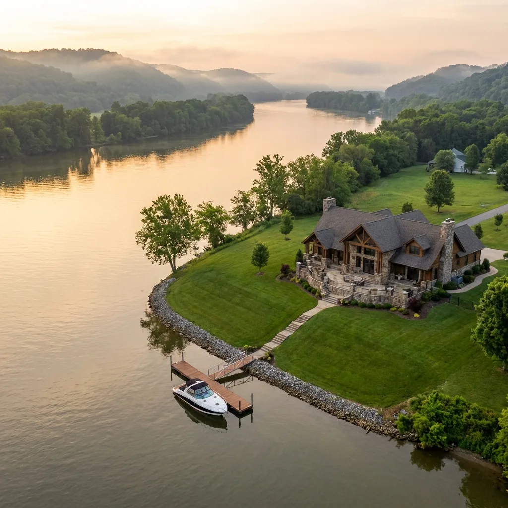
Residential Property - Aerial Front Elevation
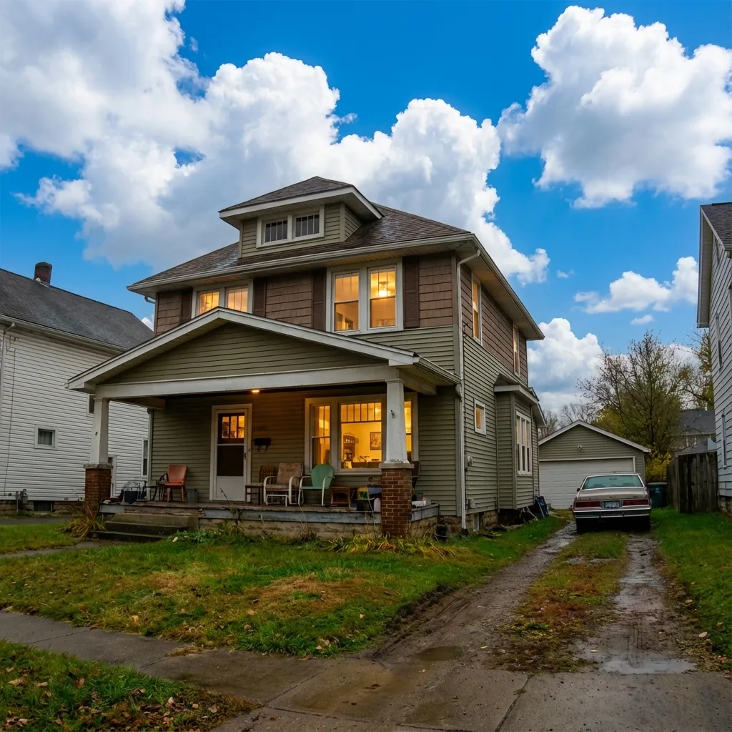
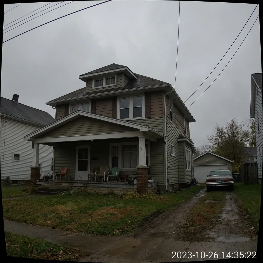
Edits applied: Sky replacement with natural blue sky and clouds, exposure balancing across the entire frame, color saturation enhancement, grass and landscaping green boost, shadow recovery in eaves and entryway, and lens distortion correction for straight vertical lines.
Living Room - HDR Bracket Merge
Edits applied: HDR bracket merging of 3-5 exposures, window pull technique to recover outdoor views, interior flash layer blending, white balance correction for accurate wall and flooring colors, vertical line straightening, and shadow detail recovery in furniture and corners.
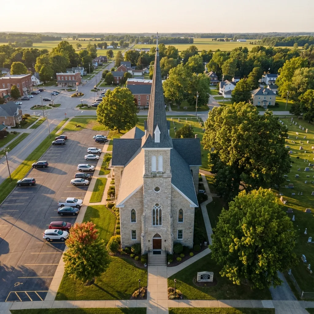
Hilltop Acreage - Drone Aerial Overview
Edits applied: Dehaze filter to cut through atmospheric haze, sky enhancement with natural cloud detail, foliage color correction to bring out seasonal greens, contrast boost for terrain definition, shadow and highlight recovery, and sharpening for fine detail in tree lines and ridgelines.
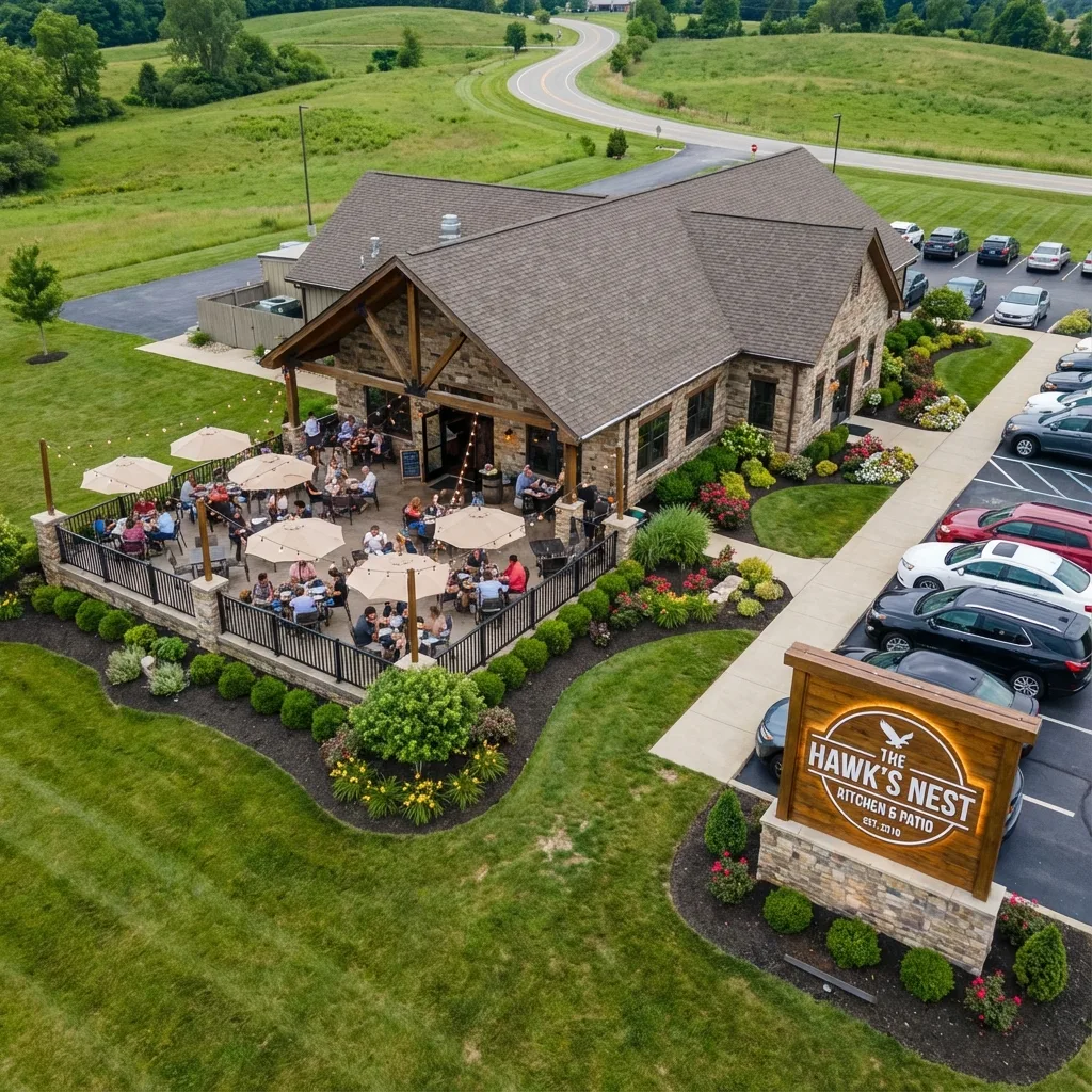
Luxury Home - Twilight Drone Elevation
Edits applied: Twilight sky replacement with natural dusk gradient, interior warm light compositing through windows, exterior exposure lift to reveal architectural details, color temperature blending between warm and cool tones, and noise reduction for low-light clarity.
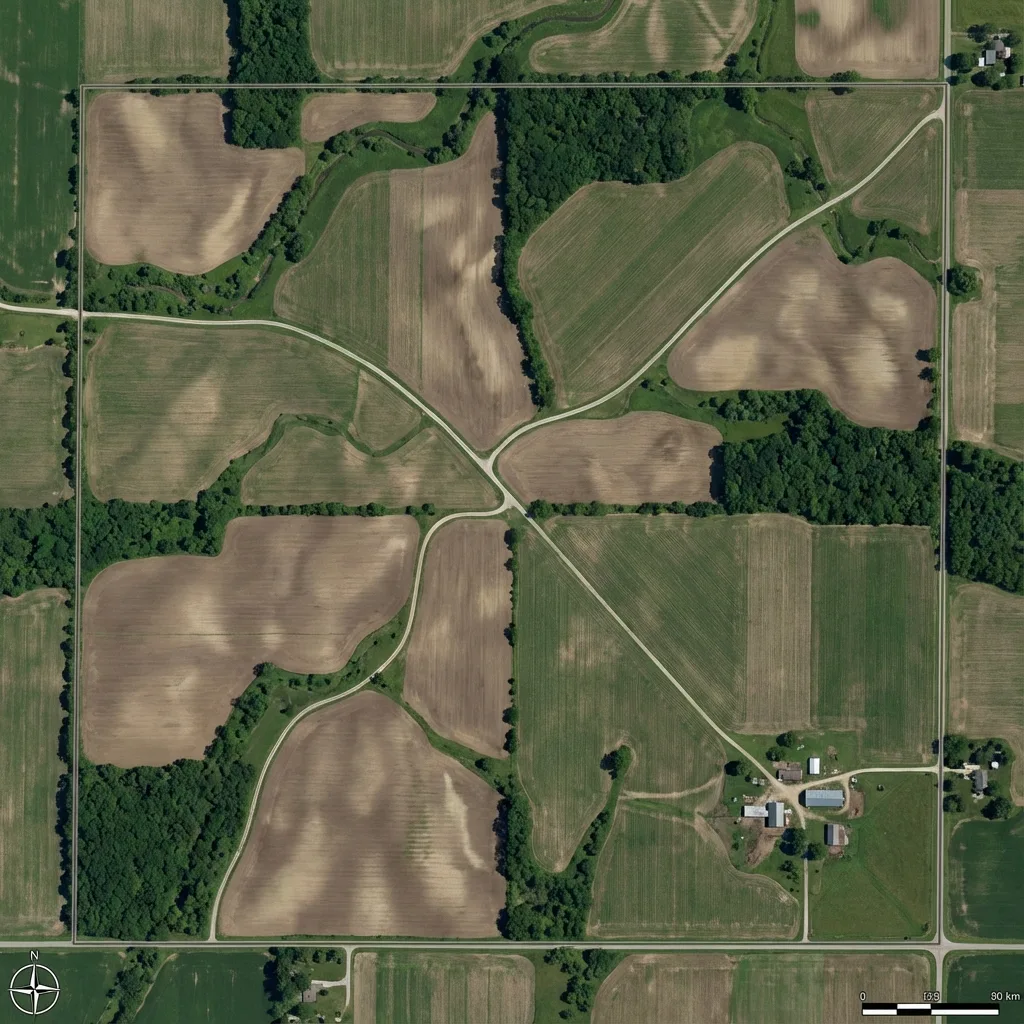
Rural Parcel - Overhead Land Survey
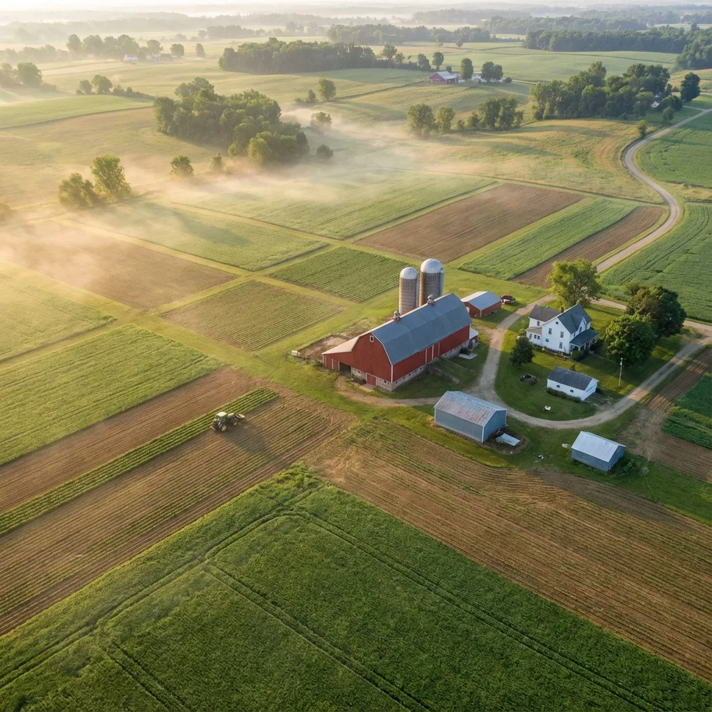
Edits applied: Contrast and clarity boost to define field boundaries and terrain features, sky replacement for clean blue backdrop, color correction for accurate soil and vegetation tones, dehaze for distant tree lines, and sharpening for property detail visibility at all zoom levels.
Our Editing Process
Every image passes through a four-stage professional editing pipeline before delivery. Here is what happens behind the scenes.
RAW Processing
Import RAW files, apply lens corrections, set white balance, and recover maximum dynamic range from the sensor data.
Color Correction
Adjust exposure curves, fine-tune color channels, correct for atmospheric haze, and ensure accurate material colors throughout.
HDR Blending
Merge multiple exposure brackets for interiors, composite sky replacements, balance interior-to-exterior lighting, and blend flash layers.
Final Polish
Apply selective sharpening, noise reduction, perspective correction, final crop for composition, and export in MLS-ready and web-optimized formats.
Frequently Asked Questions
What editing is included with drone photography packages?
Every package includes full professional editing: RAW processing, exposure correction, white balance adjustment, HDR blending for interiors, color grading, lens distortion correction, and final sharpening. We deliver polished, MLS-ready images with every order.
Do you offer sky replacement for drone photos?
Yes, we offer sky replacement as part of our editing workflow when conditions call for it. Overcast or flat skies are replaced with natural-looking blue skies and clouds that match the lighting and time of day of the original shot. The result is a clean, appealing image that still looks authentic.
How long does photo editing take?
Standard turnaround is 24-48 hours from the date of the shoot. For rush projects, we offer same-day or next-morning delivery. Every image goes through our full editing pipeline before delivery, so quality is never compromised by speed.
Can I request specific edits or re-edits?
Absolutely. We include one round of revision requests with every package at no additional cost. If you need a different crop, color tone, or sky replacement on specific images, just let us know and we will make adjustments promptly.
Want professional editing and aerial perspectives for your property or project?
View Drone Photography Services